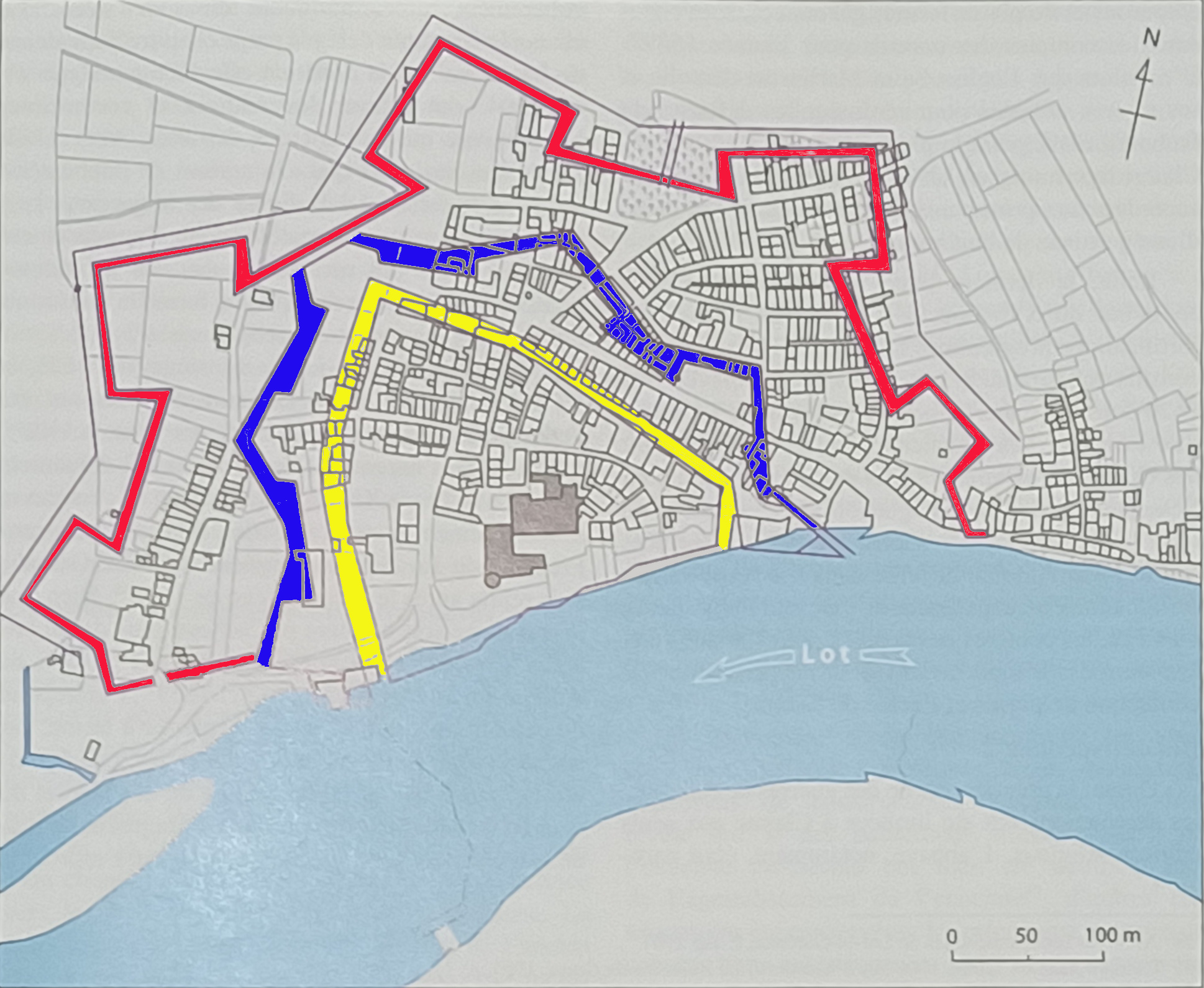
In the Middle Ages, Clairac was grouped around its Benedictine abbey overlooking the Lot, protected by a stone and brick wall. We can still read the layout of this first enclosure, delimited by rue Maubec and rue des Fossés. Raising your head, you can make out some traces of it.
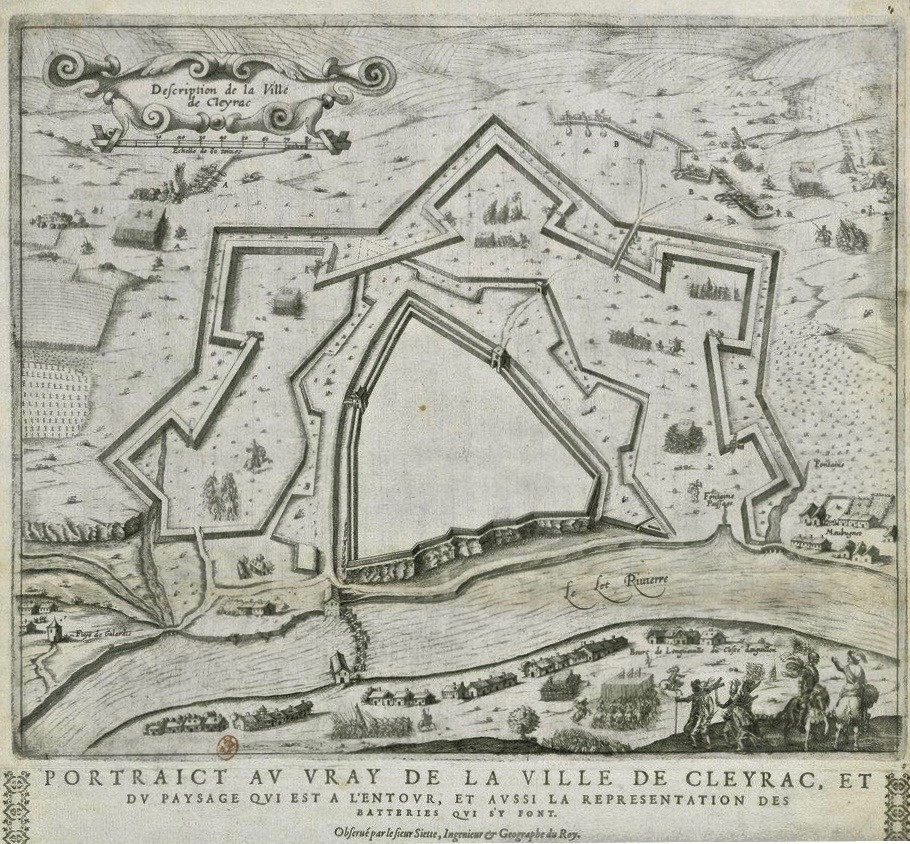
In 1620, in anticipation of the assaults of the royal army, a second bastioned enclosure was erected, wider, encompassing the “new town”. It resisted 15 days during the siege of the summer of 1621, led by King Louis XIII. Clairac's motto, City without a king, soldiers without fear, was born.
Plaque affixed to the old ramparts, place de La Roque.
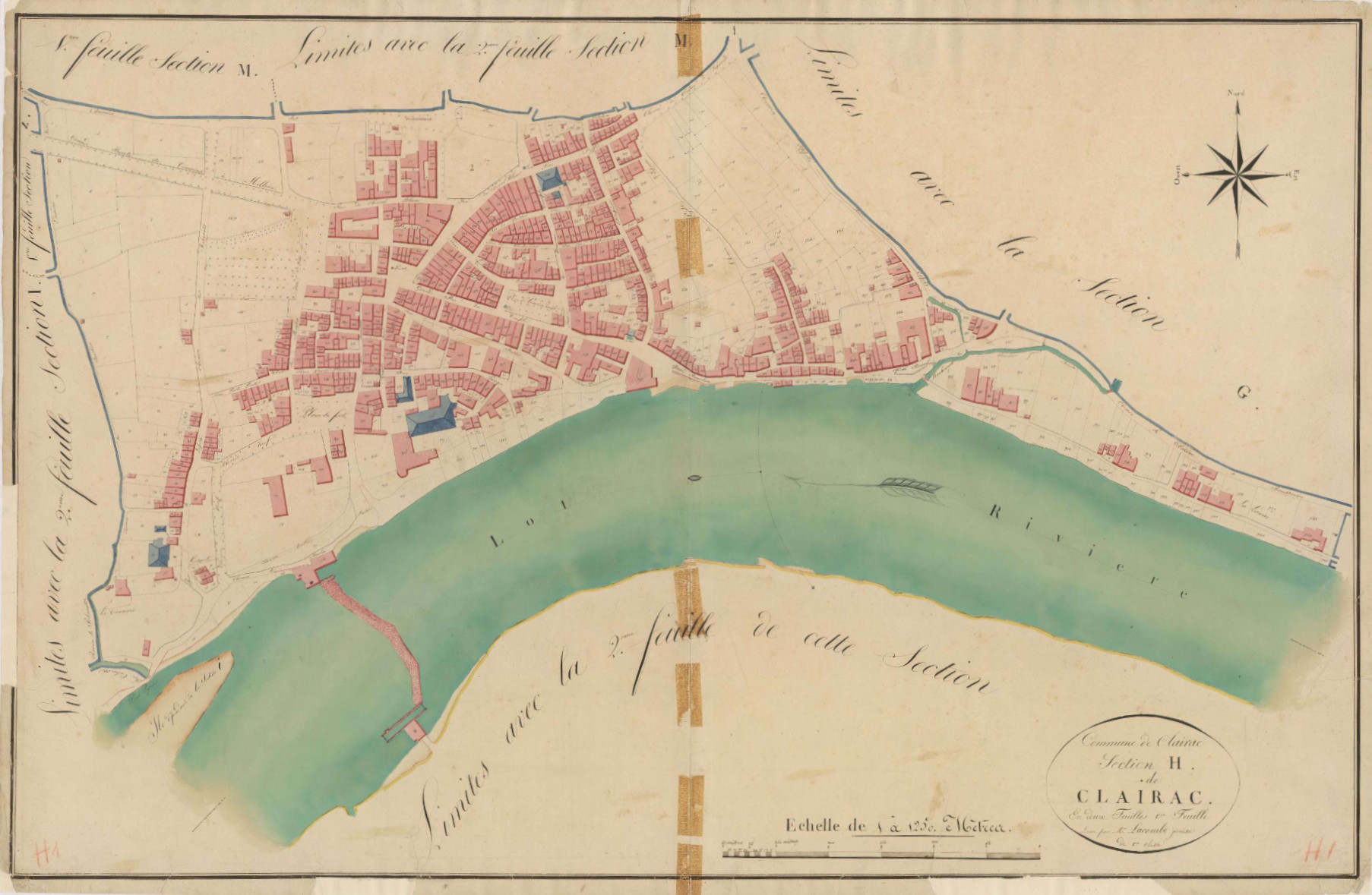
On May 21, 2016, during the symposium Clairac and its abbey, Alain Beschi made a presentation entitled Clairac, from the medieval monastic village to the Protestant stronghold. Using, among other things, engravings from the 17th centuriy and the cadastre of 1821, he reconstructed all of the city's fortifications.
Engraving. René SIETTE, engineering adviser and ordinary geographer to the King.
Engraving. René SIETTE, engineering adviser and ordinary geographer to the King.
In yellow on the following drawing, the medieval enclosure delimited by the rue des Fossés and the rue Maubec; in blue, the line of fortifications erected in the second part of the 16th century and in red, the line of bastions completed at the beginning of the 17th century.
Transfer of the layout of the fortifications of 1621 on the cadastral plan of 1821 (Drawing A. Beschi, 2001, 2016).